Sports
Not Many Hikers Seem to Know About This Trail Near Greenwater
Mountain bikers like this forested area.
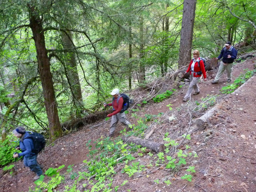


The Ranger Creek trail is a pretty, forested trail that doesn’t get much attention from hikers. The trail is seldom described in guidebooks or hiking-related websites. In addition to it being a fine trail for hikers mountain bikers also enjoy its charms and challenges. Be on the alert, as this trail is one of their favorites.
The hike is moderate – it’s 2.6 miles (one-way) to the Little Ranger Peak viewpoint (4,500 feet) and the elevation gain is gradual. Note the short spur (left) that leads to a scenic overlook (Little Ranger Peak viewpoint) with views of Suntop Mountain and surrounding foothills. Don’t be tempted to crawl out onto it for a closer look – a fall from the rock could be fatal.
From the Little Ranger Peak viewpoint strong hikers can continue another two miles to the Ranger Creek shelter at 4,960 feet. The trail is steep from the Little Ranger Peak viewpoint but it’s a good idea to call the Enumclaw branch of the Mount Baker Snoqualmie Forest for current conditions – trail work is likely to be behind schedule this
year because of budget cuts and lingering snow.
Find out what's happening in Enumclawwith free, real-time updates from Patch.
Though this hike couldn’t be considered a wildflower hike there are flowers along the trail. In late May through June look for Calypso orchids like tiny ballerinas gracing the dark forest duff. Later in summer vanilla leaf predominates; pioneer women used vanilla leaf to freshen their linens. Vine maple appears at low to mid elevations, suggesting this trail also makes a splendid fall-color hike.
If you get to the Ranger Creek shelter look for marsh marigolds beside small streams and boggy areas. The shelter was built by the Boy Scouts of America and provides an ideal setting for lunch or a turnaround, especially on a rainy day.
Find out what's happening in Enumclawwith free, real-time updates from Patch.
Experienced hikers can study the map for loop hikes and other options.
To get there: From Enumclaw head east on State Route 410 and between milepost 54 and the Buck Creek Recreation area, park
on the shoulder of the road (left side). Hike a short spur from the highway to a junction with the White River trail (No. 1199) where the hike begins. At this junction turn right, continue 0.2 miles to the junction for the Ranger Creek Trail (No. 1197), elevation 2,800 feet at the end of a switchback. If you get to a stream crossing, you’ve gone
a bit too far.
Statistics: Round trip to Little Ranger overlook is 5.2 miles, round trip to Ranger Creek shelter is 9.2 miles. It is about 2,000 feet elevation gain to the viewpoint and 2,460 to the Ranger Creek shelter. The map is Green Trails No. 238 Greenwater, WA.
For additional information and road/trail conditions call the Enumclaw office of the Mount Baker Snoqualmie National Forest at 360-825-6585 or visit their website at www.fs.fed.us/r6/mbs